Here is my vision and goals for what I want to build next for Backseat Geologist.
Coming Soon
I have a few features in the hopper in final testing.
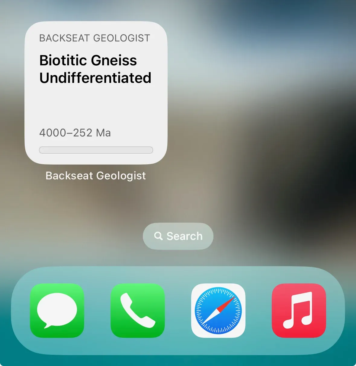
First is a widget for the home screen. This allows you to get a quick look at the geology of your current location. This does require you to allow continuous location access to have the most up to date information. I can assure you it is only for geologic data and no user location data is stored. Its like the weather widget which also requires full time location access. Of course this is optional and you can always go to the app to get the full experience.
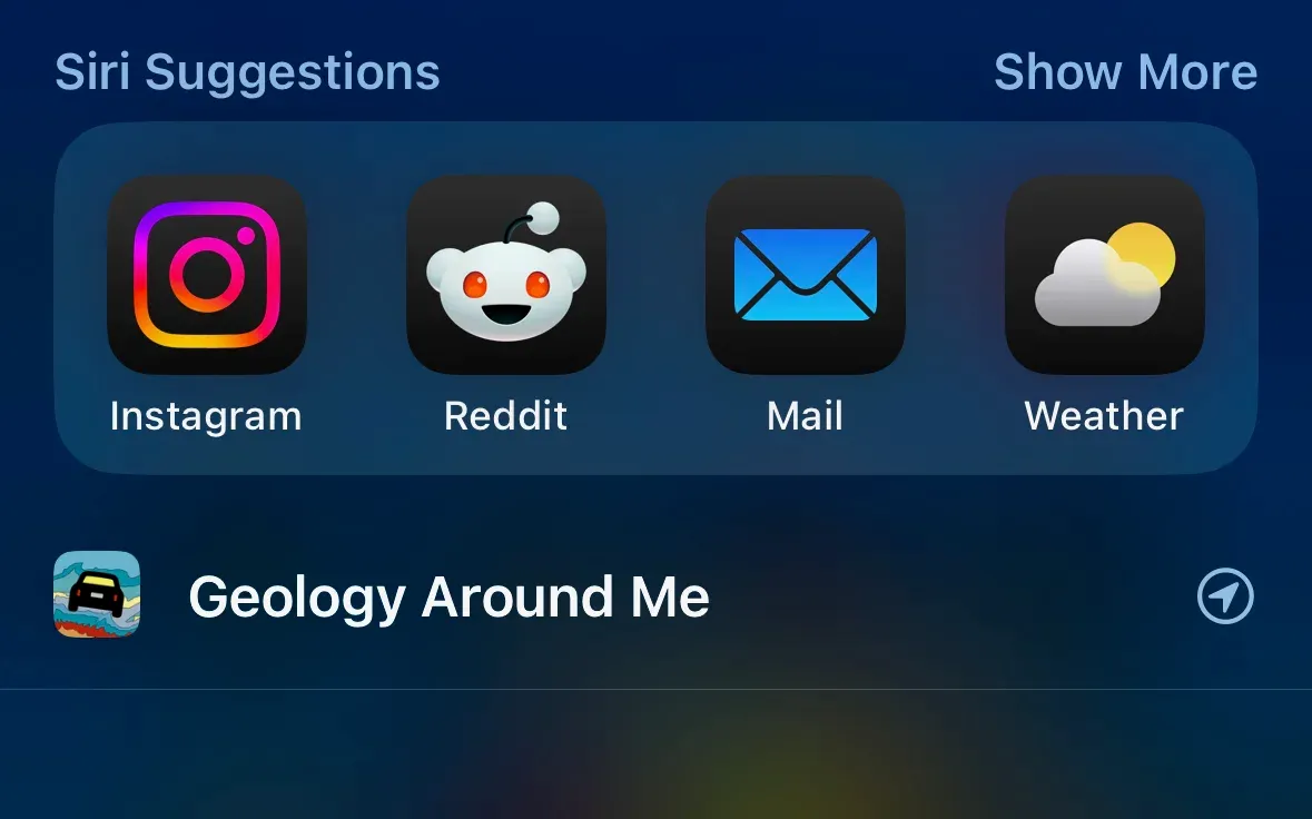
Second is a little more behind the scenes. I am adding App Intents support to the app. This allows you to give Siri geological super powers. Say “Hey Siri, use Backseat Geologist”, “Hey Siri, what is the geology around me using Backseat Geologist”, or one of many other similar phrases and Siri will tap into the app’s capabilities to tell you about the geology just like if you had opened the app. After using it for a bit you will see the app icon show up in the Siri suggestions and no longer need to say “using Backseat Geologist”. This also comes with a new app shortcut to allow automation options in the Shortcuts app.
Coming Later
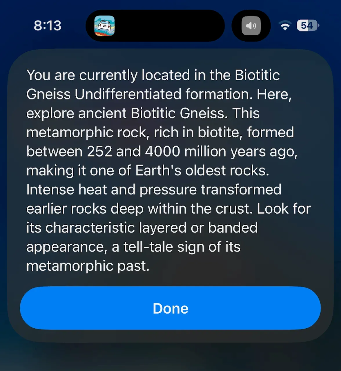
I have an idea for a (hopefully) cool new feature I am calling Overlook Mode. The idea is you get to the end of a hike, the final overlook, pull out the app and it will tell you the geology of what you can see. There are several major elements to pull this off. First I need the heading, coordinates, and elevation of your phone at the overlook. From there I send out a ray along the heading and sample elevation data along the way. With the elevation data, I define a viewshed to figure out how far you can see. At some point your view might be blocked by a mountain ridge, or it might extend to distant mountains. I then take the viewshed results and determine a sampling interval to check geology data along the viewshed ray. Finally the geology data is assembled and sent to the geology description service and audio generation service.
The result is that you get a comprehensive geology description of what you can see. This feature does require an internet connection to work. I will be researching how to allow overlooks to be created ahead of time like a route and be downloaded from the gallery.
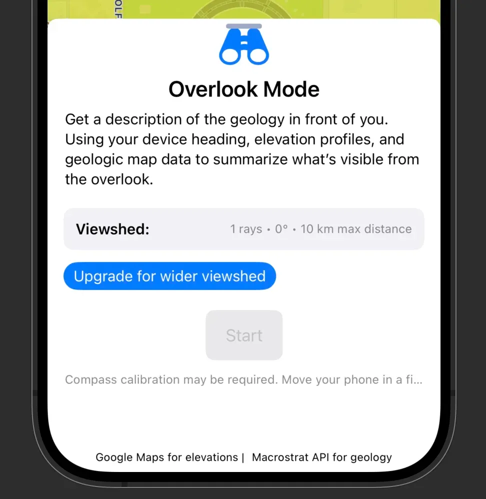
Free tier users get a single ray from their location out to a maximum distance of 10km. Premium users get a 30 degree field of view with 3 25km rays: center, 15 degrees left, and 15 degrees right. Max users get a 60 degree field of view with 5 50km rays: center, 30 degrees left, 30 degrees right, 15 degrees left, and 15 degrees right. Each ray will generate a description and take into account the other rays to prevent overly repetitive descriptions. Overlook descriptions are saved just like routes so you can read or replay them later.
Future Plans
This isn’t a comprehensive list, but here are some of the things I want to build in the future.
- Add more languages to the app so geology descriptions can be generated in more languages. I want to add Spanish, French, Portuguese, German, and Italian.
- A method to upgrade audio from lower quality to higher quality for already generated routes.
- Foundation Models support for geology descriptions to allow on device generation.
- iOS 26 liquid glass design updates
- Add more routes (and overlooks) to the Gallery
- Android version! This has been highly requested but will take time to build.
I hope you stick around for the journey!